
Scenic Places to Photograph outside of Acadia
Acadia National Park gets millions of visitors a year. Additionally, most of them look to capture that perfect picture while hiking. Granted, there are plenty of photo opps on Mount Desert Island. However, most of them have been captured from every conceivable angle by some of the best photographers in the world.
I totally get wanting to capture the view from the top of Cadillac Mountain with your iphone. However, it’s been done many times before by better photographers with better equipment.
Where are good but lesser known photo locations?
In a sense, this is a moot topic. I honestly believe that you can throw a rock anywhere in Maine and find something cool to capture on film (or digitally). Although I’m partial to dilapidated barns and snapshots that capture the realities of rural life, most people prefer vistas and rugged coastlines.
Regardless of what you’re looking to photograph, here are some scenic places that are worth a trip with your camera in hand.
Hopefully, people will see your non-Acadia pictures and say “Oh Wow! Where is this at?”
Location
The quiet coastal village of Milbridge, Maine is about 30 miles north of Acadia National Park, as the crow flies.
Milbridge is situated directly on Narraguagus Bay with lots of coastal access. Consequently, opportunities abound to take interesting coastal and inland photos. In addition, the year round population is with only marginal seasonal spikes upward in the Summer through Fall months. This means that you can count on relative solitude when lining up your shots, even during high tourist season.
 Milbridge Maine on Ray’s Point looking out to Flat Bay by Maineterrain.com[/caption
Photo Spots within Milbridge:
McClellan Park
This park is one of the best kept secrets in coastal Washington County. Donated to the state by New York Mayor George B. McClellan in 1925, the park has picnic areas, camping areas and trails to explore.
Incidentally, McClellan was the son of Civil War Union General George McClellan. Even though both are long deceased, I refer to him as the former Mayor of New York. I suspect McClellan Jr. was sick of being introduced as the son of the Civil War hero. He was Mayor of New York for crying out loud. That’s a pretty impressive accomplishment, don’t you think? Let’s give the man his due.
The tide pools and rock formations along the shoreline at McClellan Park are comparable to what you’ll see in Acadia National Park but without the crowds. One of my favorite things to do here is bring a lunch or dinner, find a picnic table close to the water and watch the sunset. Camera or no camera, it’s a spectacular sight at an incredible venue.
Finally, the paths can be uneven and rocky. If you are not steady on your feet, this may not be a great photo location to explore. There are restrooms on-site.
Narraguagus River Bridge
Although technically in Cherryfield, this historic Warren through truss walking bridge is now part of the Downeast Sunrise Trail. It is Milbridge adjacent.
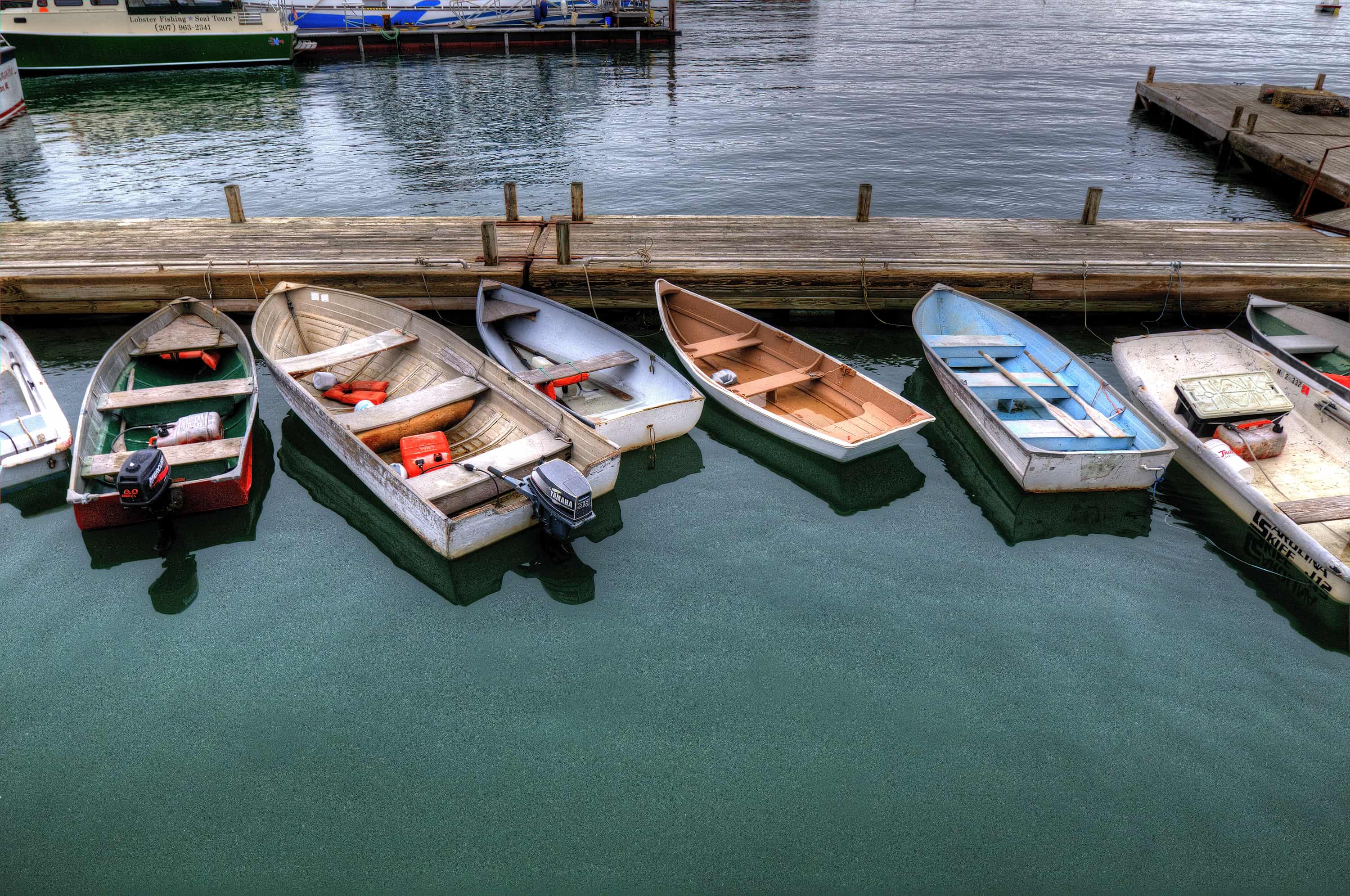
Chipman’s Wharf
Chipman’s Wharf is an active working wharf owned by the Chipman family. It has been a Chipman family operation for generations.
Located right on the Narraguagus Bay, the wharf services lobster boats and sells their catch right off the dock. It’s a great site to take pictures of a working wharf.
Keep in mind that Chipman’s Wharf is a privately owned business. Thus, you should ask permission before walking onto the wharf to take pictures.
Location
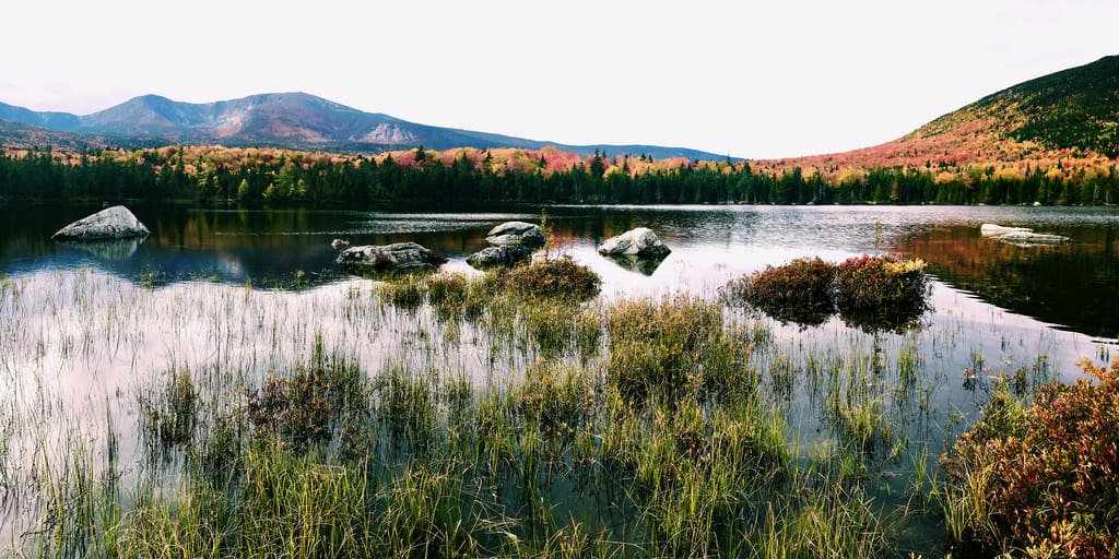
Baxter State Park is located in the North Woods region of Maine in Piscataquis County. It is at the far north end of the Appalachian Trail.
I debated whether or not to include Baxter State Park in this article because it gets a lot of visitors. Certainly, it is hardly a secret spot for photography. However, if you’re looking for something spectacular outside of Acadia, Baxter State Park definitely qualifies.
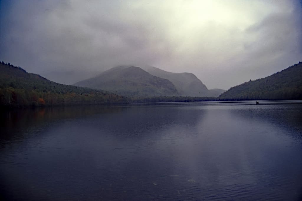
Photo Spots within Baxter State Park
Sandy Stream Pond
Sandy Stream Pond is an excellent place to capture pictures of wild moose in Baxter State Park. In keeping with the park’s Forever Wild theme, moose frequent the pond in the mornings and evenings. Thus, bring a long lens to get a closeup shots without spooking the moose.
However, with or without moose, Sandy Stream Pond is a classic backdrop for capturing the Baxter State Park’s natural beauty.
South Branch Pond
South Branch Pond is much more accessible than Sandy Stream Pond but just as scenic.
If you are looking to take pictures from a kayak or canoe vantage within Baxter State Park, consider Sandy Stream Pond.
Here’s why:
- It is located in a campsites that gets very little visitors compared to other sites in the park.
- You can rent kayaks or canoes for the ridiculously low price of $1/hour.
- Sandy Stream Pond has a rock bottom rather than mud. Accordingly, if you plan on going into the water yourself, stone bottom ponds are much less attractive to leeches than mud bottom ponds. Thus, you can dip your toes in here without worry (if leeches freak you out.)
Waterfalls of South Branch Falls Trail
After you are done at South Branch Pond, take a few minutes to walk over to the South Branch Falls Trail. There, you will find a series of spectacular but not intimidating waterfalls that you can wade into. In keeping with the low visitor count in this region of the park, you will often be alone here even during high tourist season.
Location
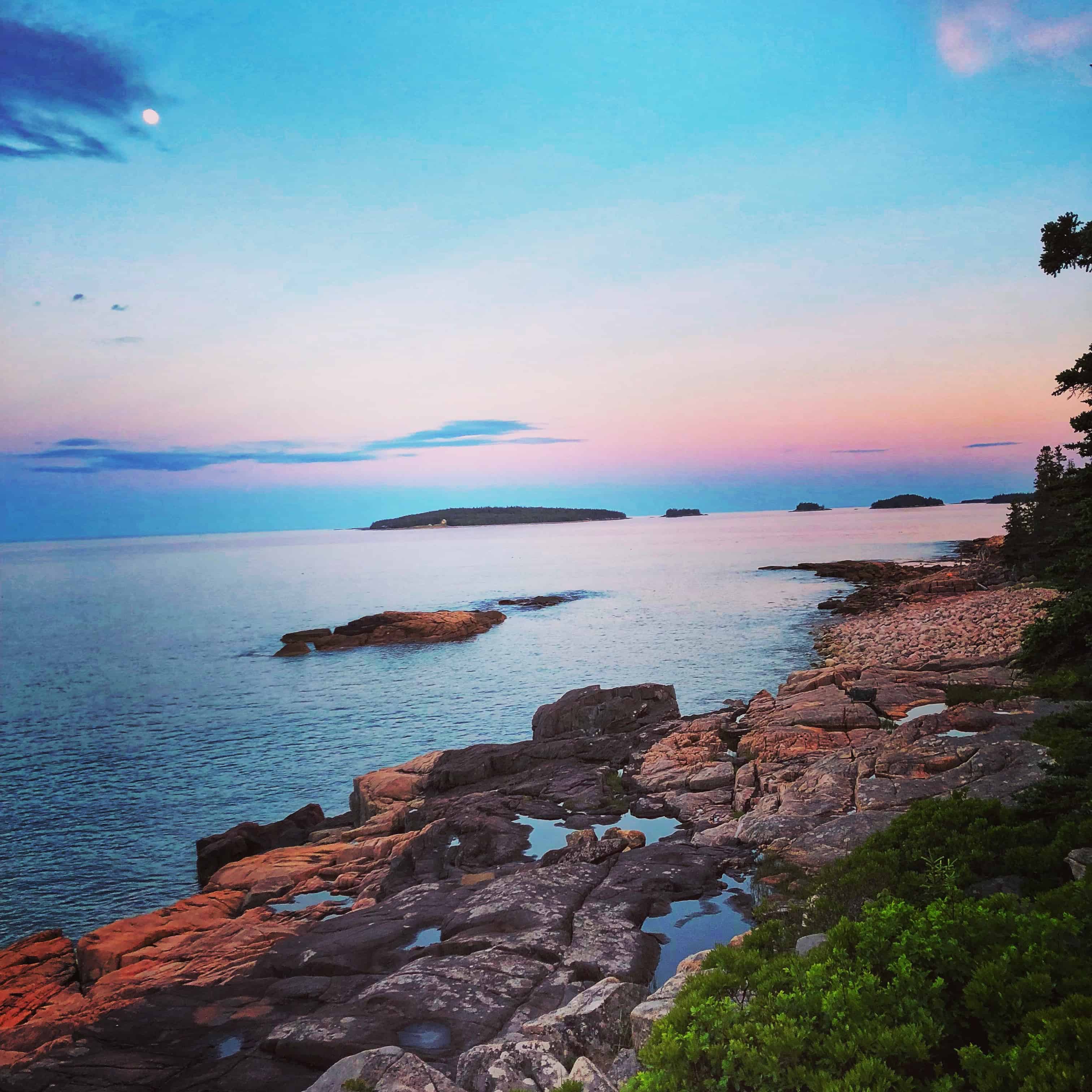
On the East Coast of Maine, just a stone’s throw from Canada you’ll find the charming seaside town of Lubec.

Photo Spots within Lubec
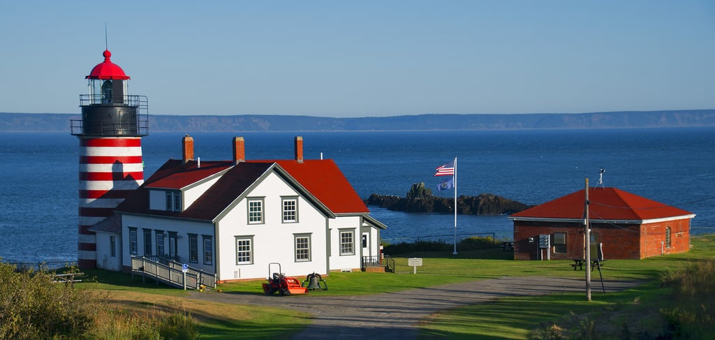
West Quoddy Lighthouse
With its signature clean red and white stripes, the West Quoddy Lighthouse is a magnet for camera wielding visitors. Get there in the early morning hours to be among the first people in the United States to witness sunrise.
There is a reason why New England Travel Today named West Quoddy Head Lighthouse as one of the ten most beautiful places in Maine.
The Lubec Coastline
I know the term unspoiled beauty gets thrown around a lot when describing areas of Maine. However, as stated by Lubec resident Bob Judd in an article for Down East Magazine, “You can go to Cobscook Bay, see no houses, no boats, and say this is what Champlain saw in 1604.”
Lubec has huge variations in high and low tides. Accordingly, it can be beautiful but dangerous. If you are looking to capture the fury of maritime nature in an unspoiled setting, the Lubec coast may be the spot.
Location
Aroostook County is located in the sparsely populated North Woods region of Maine. It sits on the Northern US-Canada border.
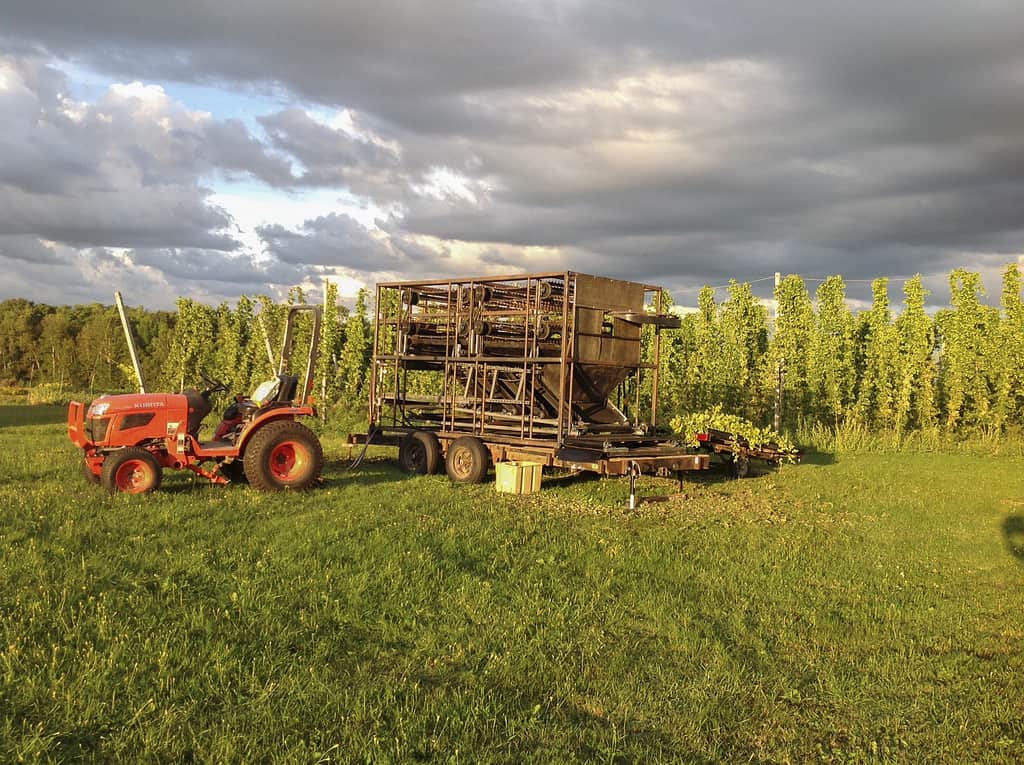 “Fresh hops from Aroostook Hops” by Allagash Brewing is licensed under CC BY 2.0 [/caption]
Photo Spots within Aroostook County
Allagash Wilderness Waterway
The Allagash Wilderness Waterway was designated as a protected area by the people of Maine in 1966. At the time, the stated goal was to “develop the maximum wilderness character” of the river.
As a photographer, reap the benefits from 50+ years of Maine’s protection efforts. The waterway covers just under 100 river miles and has no permanent residents. Take a canoe and photograph the same legendary scenes Henry David Thoreau wrote about years ago in The North Woods.
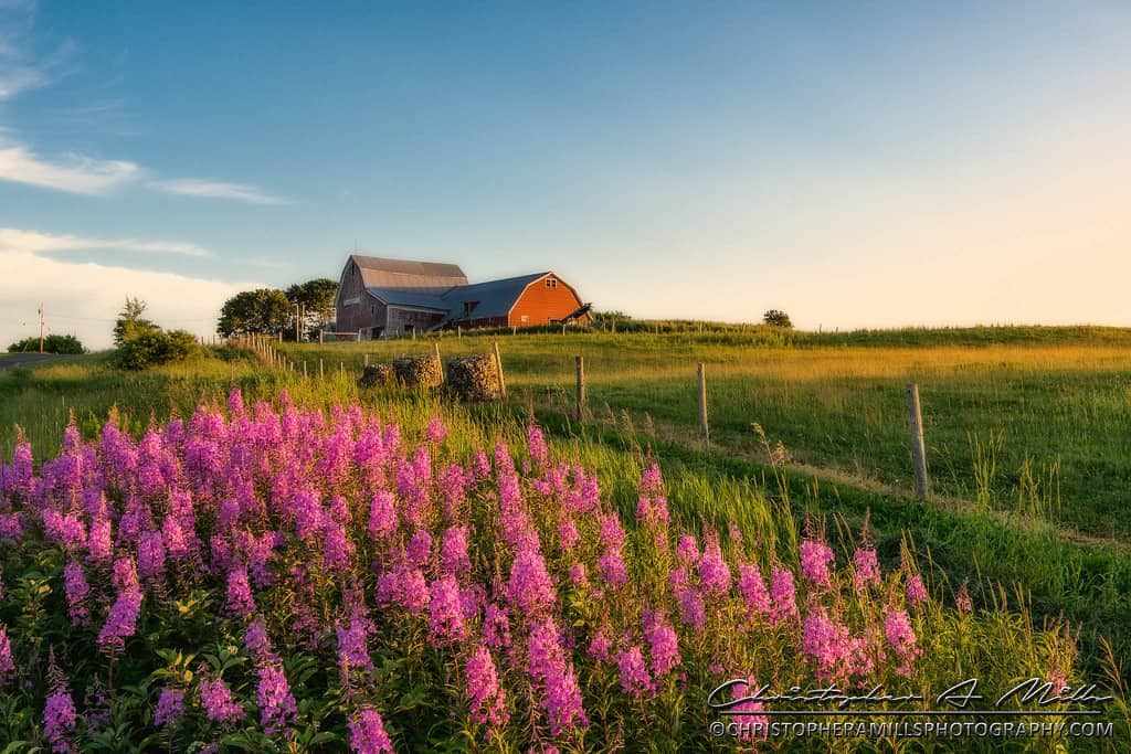
Aroostook Potato Fields
Tons of potatoes are grown in Aroostook County. It is a major crop for local farmers.
Why are so many potatoes grown here? It’s because the soil conditions are so fertile.
For photographers, that means beautiful landscapes with striking colors abound. Also, if you like potatoes and are not on one of those no-carb diets, all the more reason to head North!
Location
Whiting, Maine is a quiet town in Washington County with just under 500 residents. It has many water views from rivers, lakes and the Atlantic Ocean.
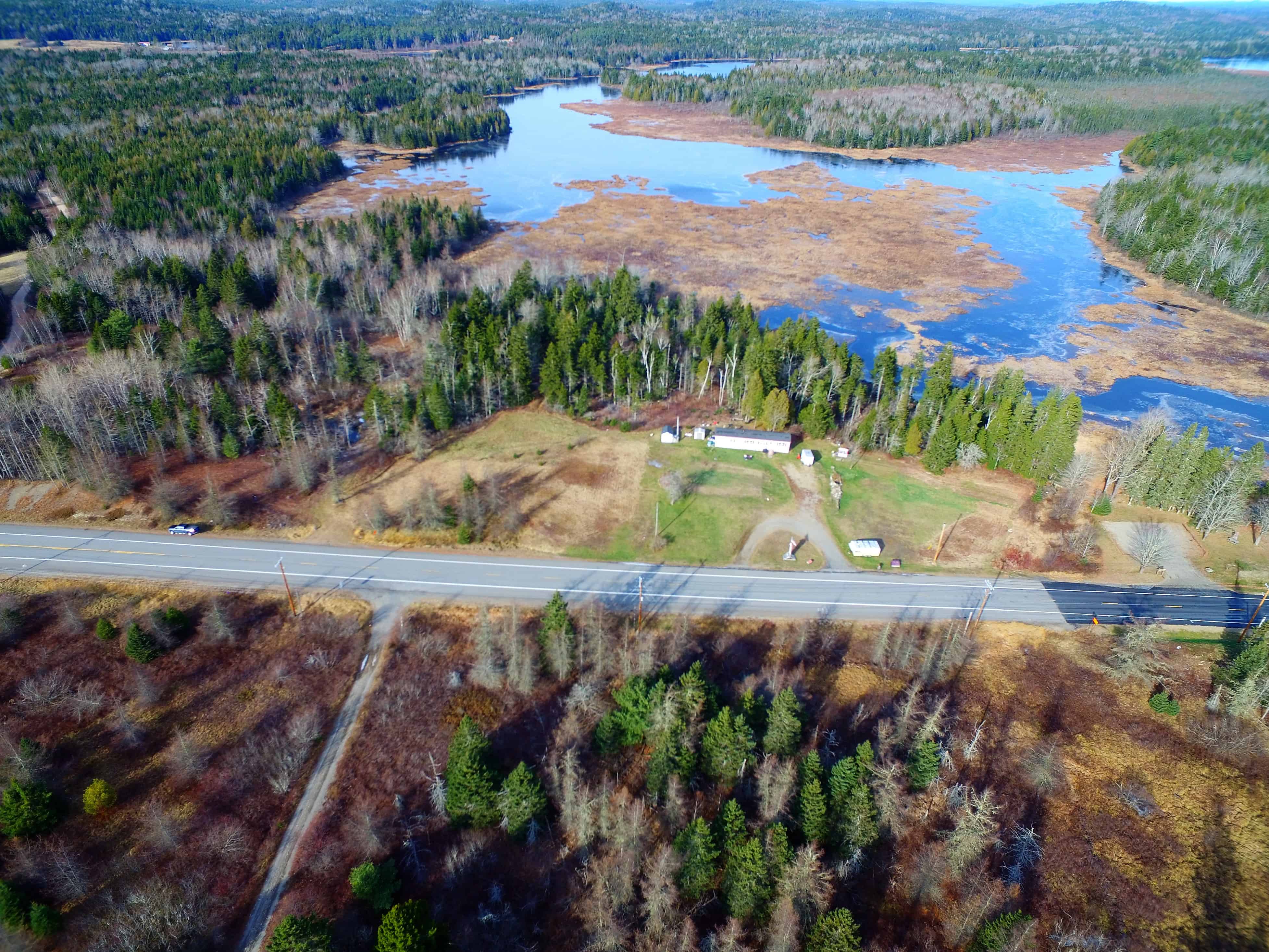
Photo Spots within Whiting
Orange River Water Trail
Wildlife abounds on the Orange River. Because of it’s proximity to US-1, you can literally hop out of your car and be in the river quickly. This means no long hikes hauling your camera equipment.
My suggestion is to explore the river by kayak or canoe. A great access point is the Reynolds Marsh Overlook. The Downeast Coastal Conservancy manages much of the land in the area. Not surprisingly, they have great suggestions for hiking, boating access and wildlife watching on their website here.
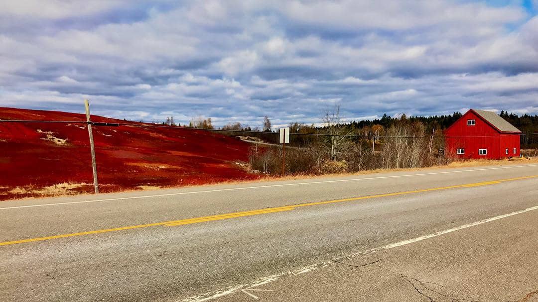
Blueberry Barrens of Whiting, Maine
This is a seasonal recommendation. Washington County accounts for 90% of the blueberry production in the United States. Blueberries flourish in Whiting.
In case you didn’t know, barrens refer to the sandy soil plains that are optimal for blueberry growth.
In Fall after harvesting, the barren turn a wild shade of fluorescent red. Just driving along US-1 you’ll find amazing photo opportunities from the roadside.
To get a sense of the photo possibilities, check out Instagram feed of Whiting’s own Josh Pond Farm.
Conclusion
Many people reading this article may have a laundry list of photo sites that are missing from this article. My purpose here is to provide a jumping off point for photo locations outside of Acadia National Park. This article should probably be the first in a series of 77!
Anyway, if you need more Maine photo location ideas, take out a map, close you eyes and point. It’s the most photo-worthy state in the US, as far as I’m concerned.
Gay
14 Apr 2019I am in fact grateful to the holder of this website who has shared this impressive
post at at this place. http://www.crescentmoonhky.com
Pingback: Down East Drone Pilot, Ryan Malagara - Maine Terrain